• This site contains eBay affiliate links for which Sea-Doo Forum may be compensated.

advice on which gps to get.

Status
Not open for further replies.

OrangeAnimal

New Member
Just like it says. I need alittle advice on what GPS to get. I want something small and simple. I really don't even need a map. The features I want are

1. Program a start location and return to it.
2. Speed.
3. Compass.
4. Waterproof of course.
5. Small Size no big dash mount things.
6. Easy to read especially in the dark.

I am going to put in my 2000 Challenger. I travel to many places and some look so much alike,Amistad in Del Rio Texas is a good example. That place all looks the same along the shore and is HUGE.
 
I have the Triton 400 from Walmart. $150, does exactly what you ask, plus you can download maps if you ever need them. Buy the extra suction cup mount and you can mount it in your car windshield, off the dash of your boat, etc.

Took these pics for another member a couple weeks ago. May as well post them here.
 
Last edited by a moderator:
OF COURSE that is Seadoo Forum on my screen. I had actually been PMing back and forth with Seadoosnipe about GPS units when I took those pictures. Luckily I kept them and was able to post them up here.

Can anyone recognize my little Velociraptor layed over under the screen? He is my constant online companion, but he often falls over. Especially when I take pictures of anything on my desk, such as this...

He is standing up right now, I promise, but whenever I take a picture and post it to the internet, he is being lazy and laying over.:hat:

158.jpg
 
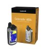
I got the Garmin Colorado 400c that comes preloaded with blue charts. The unit retails for almost $600 dollars but if you wait for specials you can get half that price. I got it for $330 around x-mas time from West Marine.
 

Attachments

  • 9394552.jpg
    9394552.jpg
    32.5 KB · Views: 18
Last edited by a moderator:
I got the Garmin Oregon 400c.

Advanced, rugged, touchscreen handheld with preloaded maps (BlueChart® g2 coastal charts with limited capability for U.S. and Bahamas), barometric altimeter, wireless data sharing, touchscreen, high-sensitivity GPS receiver, color display, microSD card slot.

The charts by themselves are over $300. If you're interested in the coastal areas, it's worth it. I then added a SD card and loaded the road maps. If your interested in lakes or hiking, you can add the inland lakes or topo maps. Those are more limited though. If you want all the lakes, you can get the 400i. Each set of maps you add are about $100 or so.
 
Status
Not open for further replies.
Back
Top